Gold Award! Integrated Multi-Method Geophysical Exploration Drives Breakthrough in Graphite Prospecting
Recently, at the 2025 Science and Technology Awards evaluation organized by the Hebei Geophysical Society of China, the project“Graphite Exploration Project of the Houdaxingde Area, Kangbao County, Hebei Province”was awarded the Gold Prize for Geophysical Engineering. The project was implemented by the Hebei Institute of Geological Surveying and Mapping. Through the integrated application of multiple geophysical methods, the project achieved significant breakthroughs in the exploration of concealed graphite deposits beneath cover. The results have been incorporated into Hebei Province’s strategic mineral resources reserve planning.

Scientifically Designed Technical Framework Addressing Challenges of Covered Terrains
The Houdaxingde area in Kangbao County is characterized by plateau–hilly terrain, well-developed cover layers, and poor surface exposure. Graphite orebodies occur mainly as stratiform and lenticular bodies concealed at depth, making them difficult to detect using conventional geological mapping or single geophysical methods. To overcome these challenges, the project team systematically analyzed the regional geological setting and developed a multi-method integrated geophysical exploration strategy.
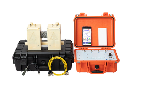
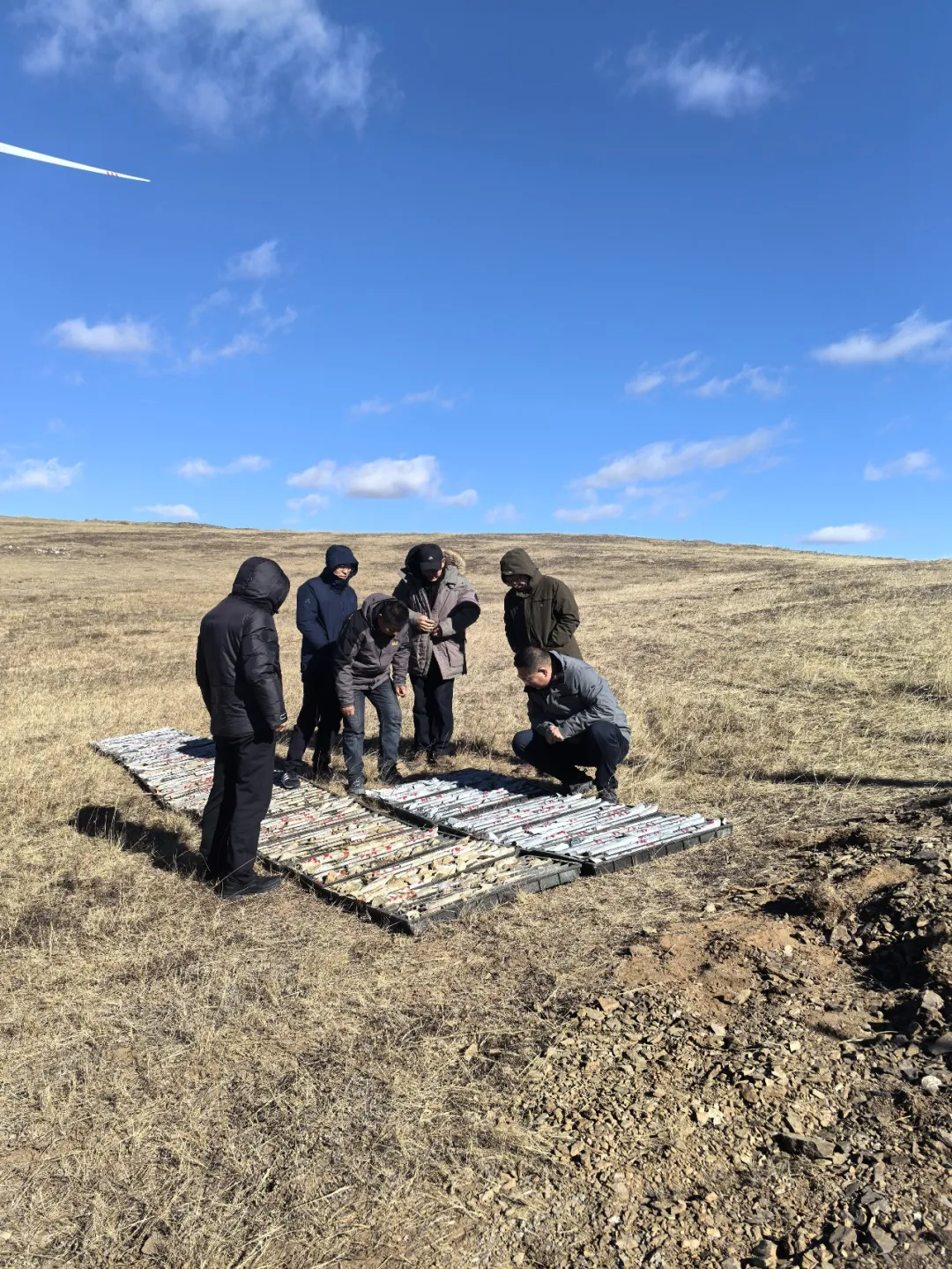
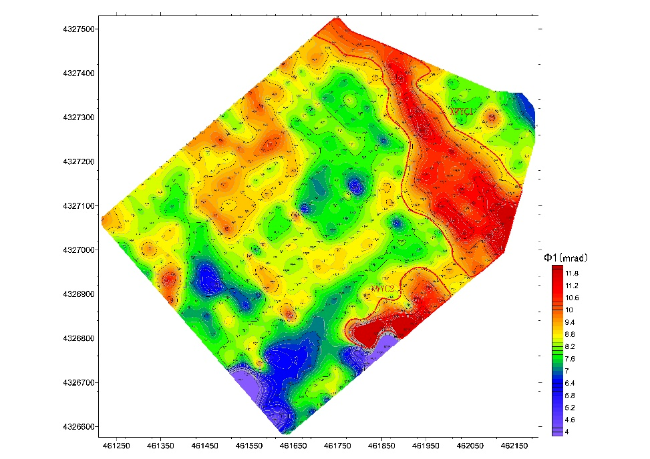
A three-stage progressive exploration model—areal coverage, linear profiling, and point-scale verification—was implemented to acquire subsurface electrical property information at multiple scales, enabling accurate identification and comprehensive interpretation of ore-related anomalies. At the areal scale, IP gradient array surveys were conducted to achieve full coverage of the target area and delineate anomaly concentration zones. At the profile scale, Spread Spectrum Induced Polarization (SSIP) and Audio Magnetotelluric (AMT) soundings were deployed to characterize deep electrical structures. At the point scale, high-resolution IP logging was used to precisely determine ore-bearing horizon depths and spatial distribution. Meanwhile, 3D geological modeling techniques were applied to integrate and interpret multi-source geophysical datasets, providing a robust scientific basis for engineering deployment.

Refined Interpretation of Anomalies Enhancing Exploration Success Rates
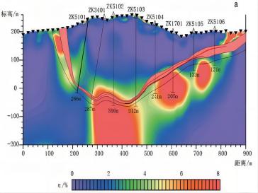
To improve deep orebody recognition, the project introduced SSIP sounding technology, which offers strong anti-interference capability, greater investigation depth, and stable inversion performance. The inverted sections revealed low-resistivity, high-phase, and high-frequency dispersion anomalies, showing strong spatial correspondence with the geometry and burial depth of graphite orebodies. All trenching and drilling programs designed based on these results successfully intersected mineralization, confirming the applicability and effectiveness of SSIP technology for graphite exploration in covered areas.
During exploration, multiple rounds of comparative analysis were conducted on geophysical anomalies. In cases where local logging anomalies did not fully match core electrical properties, the technical team re-verified raw data, optimized interpretation models, and introduced artificial intelligence–assisted inversion algorithms to comprehensively assess anomaly origins. These efforts ultimately confirmed that the anomalies were caused by concealed ore-bearing layers, further expanding the exploration potential.

Delineating Orebody Scale and Establishing a 3D Integrated Exploration System
Through systematic exploration and engineering verification, the project identified several graphite-bearing horizons and delineated more than ten graphite orebodies. These orebodies are predominantly stratiform, with considerable strike length and thickness, and remain open for further extension along strike and dip. Based on these achievements, the project team established a three-dimensional exploration system characterized by multi-parameter integration, multi-scale linkage, and multi-method cross-validation.
This approach effectively reduced uncertainties arising from the non-uniqueness of single geophysical methods and significantly enhanced both macro-scale orebody delineation and micro-scale structural characterization at depths of up to several kilometers. The methodology provides a replicable and promotable technical pathway for the exploration of deep strategic mineral resources.

By the end of 2025, the project results passed evaluation by the Geophysical Professional Committee of the Hebei Geological Society of China. The review panel noted that the project successfully integrated traditional geophysical techniques with modern data processing technologies, achieving precise targeting of concealed graphite orebodies under complex geological conditions. The project serves as a valuable demonstration of the role of geophysical technologies in supporting strategic mineral resource exploration. Moving forward, the project team will further refine integrated interpretations and engineering validation in combination with regional metallogenic studies, providing a solid geological foundation for the future development and utilization of graphite resources.
-
 GSAI Geophysics Participates in FMF 2026 in Riyadh, Strengthening Cooperation in the Middle East2026-01-23
 -
 GSAI Geophysics Showcases Innovation and Global Vision at GEOMIN 2025, Saudi Arabia2026-01-23
 -
 Gold Award! Integrated Multi-Method Geophysical Exploration Drives Breakthrough in Graphite Prospecting2026-01-20
 -
 GSAI Geophysics Showcases Advanced Chromite Exploration Technologies at EGCE 2025 in Türkiye2026-01-08
 -
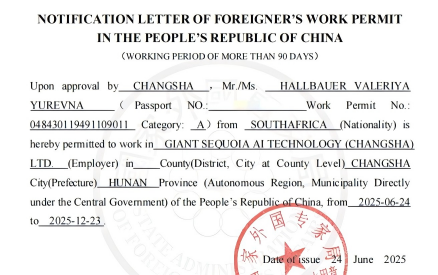 GSAI Geophysics Employs Prof. Hallbauer Valeriya Yurevna—An International Authority in Transient Electromagnetic Field to Participate in MIMO-TEM Instrument R&D2025-07-23
 -
 GSAI Geophysics Showcases Cutting-Edge Research and Global Vision at EMS 20252025-12-30
-
 New Technology: Analysis of Mineral Prospecting Effectiveness Using Spread Spectrum Induced Polarization (SSIP)2024-11-13
 -
 Exploration and breakthrough of anti-interference AMT/MT and spread spectrum IP -- A report of Chen Rujun, School of Geosciences and Info-physics, Central South University2024-01-19
 -
 Chen Rujun: Interpretation of deep secret exploration of unknown treasures2023-12-26
 -
 For the first time, the spread spectrum IP method was successfully introduced into the accurate detection of hidden fire source in Chongqing Research Institute of China Coal Science2023-12-25
 -
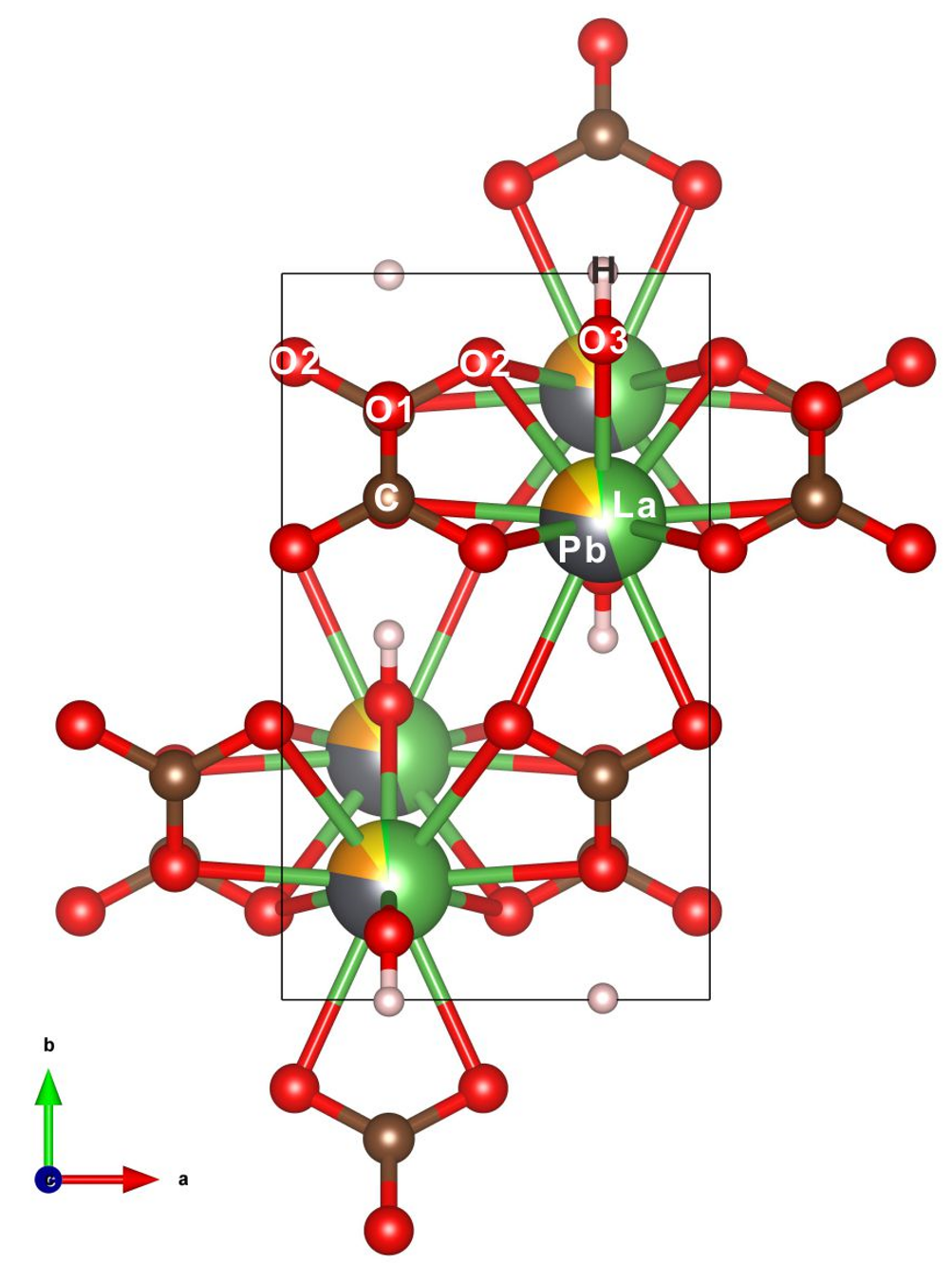 Wu Bin, Gu Xiangping et al. : The discovery of a new rare earth carbonate mineral, C-Pb lanthanide2022-05-04
 -
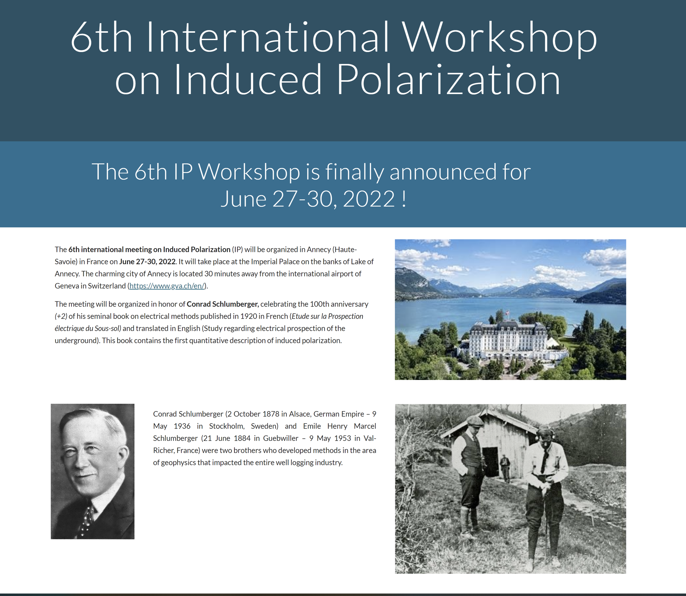 The 6th International IP Workshop2022-05-03